


Transnet reports a 696-wagon, 7.6 km freight-train record. Here is what happened, where it ran and how visitors can plan a separate Cape rail outing.
Is It Safe to Hike Table Mountain? Routes, Weather and Security
Posted on Tue September 15, 2026.
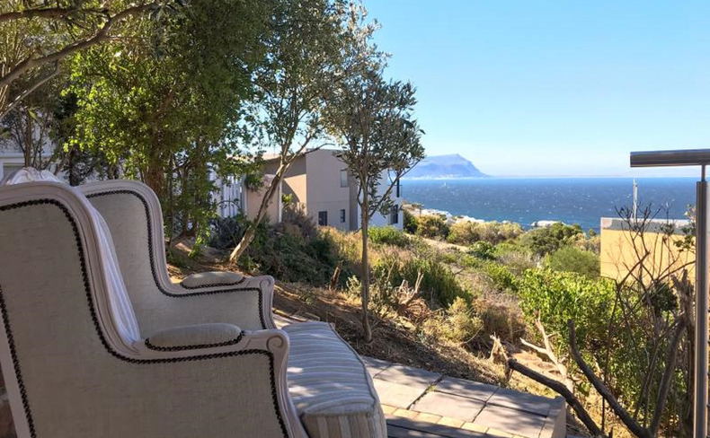
Plan a safer Table Mountain or Lion's Head hike with route choices, weather checks, transport advice and practical alternatives for windy or cloudy days.
Last reviewed: 20 September 2026
Table Mountain and Lion's Head can be rewarding hikes, but neither should be treated as a casual city stroll. The safest plan is to choose a route that matches the slowest person in your group, start with enough daylight, check the weather and official notices, and turn around before conditions become uncomfortable. The mountain is close to the city, yet wind, cloud, heat, exposure and navigation errors can still create serious problems.
Quick decision guide
- Choose a guided hike if you are unfamiliar with mountain navigation, plan a quieter route, or are uncertain about weather and security.
- Choose a busy, straightforward route if you are fit, properly equipped and comfortable following a marked mountain trail.
- Use the cableway instead if the group has mixed fitness, limited time or any doubt about descending safely.
- Postpone the outing when official notices, strong wind, low cloud, heavy rain, fire conditions or poor visibility make the plan less predictable.
Check the Table Mountain National Park information and the Table Mountain Aerial Cableway status shortly before leaving. A cableway closure matters even if you intend to hike, because it removes a possible descent option and often signals difficult wind at the top.
Table Mountain or Lion's Head?
They are different outings. Table Mountain offers several routes of very different length and difficulty, with the upper plateau adding exposure, distance and navigation decisions. Lion's Head is shorter, but includes steep, exposed sections and can become crowded around sunrise and sunset.
Platteklip Gorge is the most direct well-known walking route to the upper cable station. It is steep, sustained and exposed to sun, so a short distance on a map should not be mistaken for an easy climb. Kasteelspoort approaches from the Camps Bay side and suits walkers who have allowed more time. Contour paths and lower slopes can provide a scenic walk without committing to the summit, but junctions still require attention.
On Lion's Head, chains and ladders form part of the standard summit route. An alternative footpath bypasses some of the climbing aids, but it is still a mountain route. Anyone uncomfortable with heights or exposed rock should decide that before joining a busy summit queue.
How to plan a safer hike
Start with daylight to spare
Work backwards from sunset and include time for breaks, photographs, route finding and a slower descent. A sunset summit plan is not complete unless every person has a reliable light and is comfortable descending in darkness. For most visitors, an earlier start is the simpler choice.
Keep the group together
Agree on the route before starting and move at the pace of the slowest walker. Splitting the group can leave one person without water, navigation or a charged phone. Tell someone who is not hiking your route and expected return time, then confirm when you are safely down.
Carry the basics
Take adequate water, sun protection, food, a warm or windproof layer, a charged phone and an offline map. Shoes should grip on uneven rock. Do not rely on the city temperature or a view from the hotel, because the summit can be colder, windier and covered in cloud while the streets remain clear.
Protect valuables without losing safety tools
Carry only what you need and keep phones and cameras discreet when they are not in use. A phone is still an important safety and navigation tool, so the answer is sensible use rather than leaving it behind. If you are unsure about a route or current security conditions, use a reputable guide or ask your accommodation to help you identify an appropriate option.
Weather changes the route
Cape Town's wind and cloud can change quickly. Cloud can remove familiar landmarks, wet rock can make a simple scramble difficult, and summer heat can become punishing on exposed slopes. A strong south-easter may also close the cableway. Do not interpret a forecast as a guarantee, and do not continue only because you have already invested time in the climb.
The best decision is often to move the mountain day to the first clear, low-wind window in your itinerary. This is why visitors benefit from keeping at least one flexible day in Cape Town rather than assigning every attraction to a fixed date.
Getting to the trailhead
Walking from a Foreshore, Waterfront or central-city hotel to the lower cableway is not the same as taking a mountain walk. The approach can be several kilometres, includes sustained uphill sections and may use roads that are not pleasant for pedestrians. A ride-hail or pre-arranged transfer usually preserves time and energy for the actual hike.
Arrange the return as carefully as the outward trip. Mobile reception, road closures, crowding and cableway interruptions can affect pickup plans. Save the pickup point and driver details before beginning the hike.
When a coastal day is the better choice
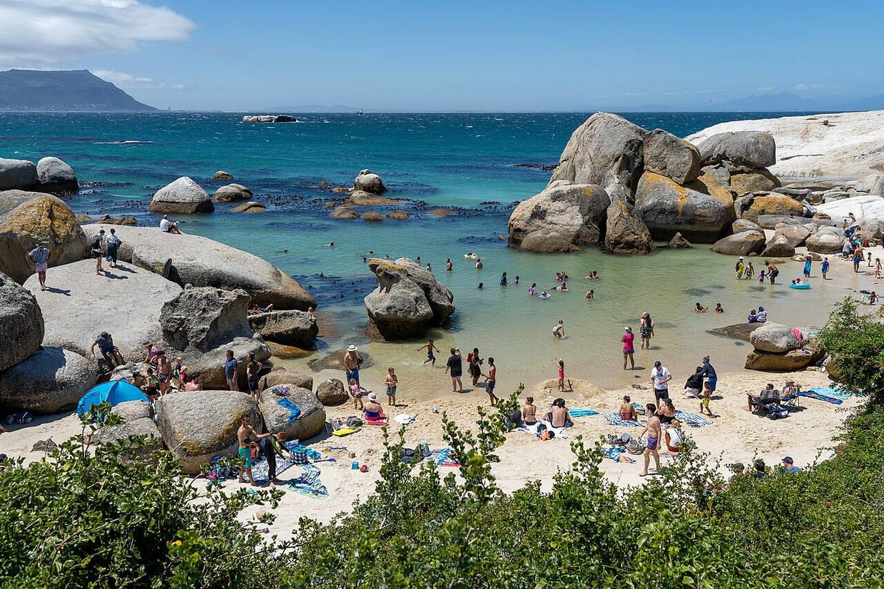
If wind or cloud rules out the mountain, the Cape Peninsula still offers excellent alternatives. Simon's Town, Boulders Beach and sheltered False Bay walks often provide a more comfortable day, although local conditions should still be checked. Our guides to planning Cape Town around wind and rain and Cape Point and Boulders Beach in one day can help you rearrange the itinerary without wasting a day.
Staying on the False Bay side
Aqua Terra is an owner-managed guesthouse in Simon's Town, convenient for Cape Point, Boulders Beach and False Bay. It works well for travellers dividing their holiday between central Cape Town attractions and the Peninsula. It is not beside the Table Mountain trailheads, so allow for a planned drive or transfer on your hiking day.
Check live Aqua Terra availability or Contact us on WhatsApp.
Frequently asked questions
Is it safe to hike Table Mountain alone?
For a visitor, company or a reputable guide is the safer choice. If you do hike without a guide, select a busy route in daylight, share your plan and avoid isolated alternatives.
Can I hike up and take the cableway down?
Yes, when the cableway is operating and you reach the upper station during operating hours. Check the live status before departure and keep enough energy and daylight to walk down if conditions change.
Is Lion's Head easier than Table Mountain?
It is shorter, but the upper route is steep and exposed, with chains and ladders on the standard line. Shorter does not automatically mean suitable for every visitor.
What if the weather looks uncertain?
Move the hike to another day or choose a lower, less exposed activity. A flexible itinerary is more useful than forcing a summit on the wrong day.
Further Reading
South Africa's 7.6 km Train: The Record Story and Cape Rail Trips
Mon October 26, 2026
Read This Article
Cape Point Triathlon 2026: Simon's Town Parking and Race-Day Guide
Wed October 21, 2026
Read This Article
Visiting Simon's Town for the Cape Point Triathlon on Sunday, 25 October 2026? Plan your parking, road access and spectator day with this practical local guide.
Is Cape Town Too Hot in January? A Cape Peninsula Planning Guide
Tue September 29, 2026
Read This Article
January can be sunny, hot and windy in Cape Town. Here is a flexible plan for heat-sensitive travellers exploring the city, Simon's Town and the Peninsula.
Share This Post