


Compare Sevilla, Stadsaal and Truitjieskraal for a Cederberg rock-art trip, with walking expectations, permits and essential road-access checks.
Beyond Augrabies Falls: A Scenic Gorge Driving Day
Posted on Mon November 2, 2026.
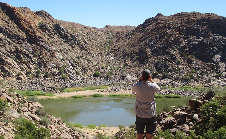
Plan an Augrabies outing beyond the waterfall, with Moon Rock, gorge viewpoints and a clear distinction between a short scenic drive and the Wilderness Road.
Augrabies deserves more than a stop at the main waterfall. For a scenic driving day, build your outing around the falls, Moon Rock and the gorge viewpoints at Ararat, Oranjekom and, if access permits, Echo Corner. Choose the roads with park staff when you arrive. A short viewpoint outing and the longer Wilderness Road are different plans, with different vehicle and time requirements.
An overnight stay makes sense if you want unhurried photography, time to watch the landscape and a second opportunity to see the falls. A day visit can still work if you choose a few priorities. This is a guide to shaping that local outing, rather than a promise that every road or viewing deck is currently open.
Start with the waterfall, then look beyond it
The waterfall gives the park its name, but the landscape downstream is a substantial part of the visit. SANParks' Augrabies park overview identifies Moon Rock, granite domes and quiver trees alongside the waterfall viewing deck. Those features offer reasons to explore even when the river does not resemble the dramatic flood photographs.
Begin at reception with the day's available viewpoints, a visitor map and your proposed return time. Ask which roads suit your actual vehicle, including its clearance, rather than describing it simply as a rental car. Confirm any walking approaches as well as the driving access. A place marked on a map is not necessarily a viewpoint you can reach without leaving the vehicle.
Visit the available waterfall decks first if this is your main reason for coming. That leaves you able to shorten the drive later without missing the one sight you most wanted. Follow closures and barriers around the viewing area; a photograph of a previously accessible platform does not establish access today.
Use Moon Rock for a different view of Augrabies
Moon Rock introduces the park's rounded granite landscape. Its appeal is different from the sound and movement of the main falls: broad rock surfaces, scattered vegetation and a much wider sense of the surrounding country. Include it as a landscape stop, rather than another waterfall photograph.
Check the current approach and walking conditions before deciding whether to go beyond the parking area. If someone in your party needs a short, level outing, ask staff to identify suitable alternatives. Driving to a named feature and walking to its highest viewpoint are separate activities; neither the name nor the photograph establishes the effort involved.
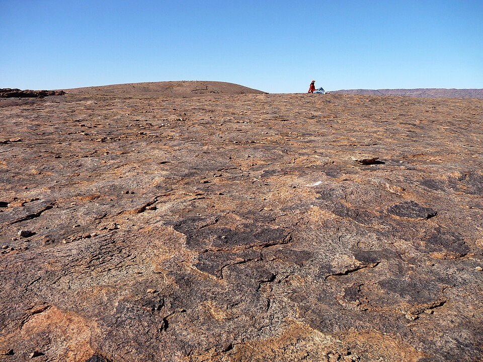
Moon Rock's granite landscape, photographed on 27 September 2008. Archival photograph, not evidence of current access. Photo: Octagon (Patrick Scales), CC BY 3.0. Unmodified web reproduction.
Make the gorge viewpoints the centre of the drive
Ararat, Oranjekom and Echo Corner are useful names to take to reception when discussing a scenic route. The 2024-2033 park management plan lists these viewpoints within the visitor infrastructure. It establishes what the park contains, rather than confirming today's road condition or which sections are suitable for a sedan.
Choose two or three stops you can enjoy properly. At each, spend a little time looking along the gorge before taking photographs. Notice how the river occupies a narrow part of a much larger rocky scene, and how a different viewing angle changes the apparent shape of the cliffs. Binoculars can add interest without turning the day into a specialist birding trip.
Do not assume these names form a continuous paved loop. Your outing may involve side roads and retracing part of the approach. Plot the sequence on the current visitor map, then work backwards from the required return time. Avoid adding a distant final viewpoint merely to complete a list.
Keep the Wilderness Road as a separate decision
SANParks' published Augrabies activity guide describes the Wilderness Road as a 94 km outing taking approximately six hours in a 4x4. It also identifies a picnic site along the route. That is a substantial driving activity, not an extra hour after lunch.
Ask the park about its current availability, conditions and requirements before committing. The published duration is a planning indication, not a guaranteed completion time. If you choose this route, build the day around it and reduce the other stops accordingly. If your priority is waterfall views and a relaxed gorge outing, a shorter staff-recommended route is a better match.
Likewise, keep hiking separate from driving. The same SANParks guide describes the Dassie Trail, but published trail lengths differ across official documents. Obtain the current route, distance and conditions from reception if you want to walk. You do not need to add a hike to justify spending a full day here.
Choose a day visit or a night nearby
A traveller's question about visiting from Upington or staying overnight captures the practical trade-off: more time at Augrabies competes with an earlier departure for the next destination. There is no single right answer for every Northern Cape journey.
For a day visit, protect time for entry, the waterfall and a limited scenic drive before the return journey. For an overnight visit, use the arrival afternoon for the falls and the following day for the gorge, subject to opening arrangements. Two nights create a full day without packing and checking out around the drive.
Check meals, supplies and accommodation directly. SANParks' visitor information identifies Kakamas as a service town for vehicle repairs and other facilities. Organise your fuel and provisions before setting out rather than assuming every viewpoint has services.
If Augrabies is part of a longer crossing, our N14 road-trip guide covers the broader corridor and detour. If that holiday also includes a separate Cape Peninsula stay, check Aqua Terra availability in Simon's Town. Plan your Augrabies nights around the park itself.
Featured photograph: Echo Corner in Augrabies Falls National Park, photographed on 22 February 2017 by amanderson2, CC BY 2.0. Archival view; featured image resized and cropped for website display. Research and editorial review: Aqua Terra, 2 November 2026.
Further Reading
Cederberg Rock Art Without Long Hikes: Sevilla and Stadsaal
Mon November 2, 2026
Read This Article
Coffee Bay, Morgan Bay or Chintsa for a Family Holiday?
Mon November 2, 2026
Read This Article
Compare Coffee Bay, Morgan Bay and Chintsa for a family holiday, including arrival plans, accommodation, beach access and what to check before booking.
Can You Visit the Drakensberg Without Hiring a Car?
Mon November 2, 2026
Read This Article
Plan a Drakensberg holiday without a rental car: arrange arrival transfers, trailhead transport, guided outings and your return journey.


Share This Post